")
")
1 December 30, 2020
Articles
1. Nana Berdzenishvili, Ninaka Berdzenishvili
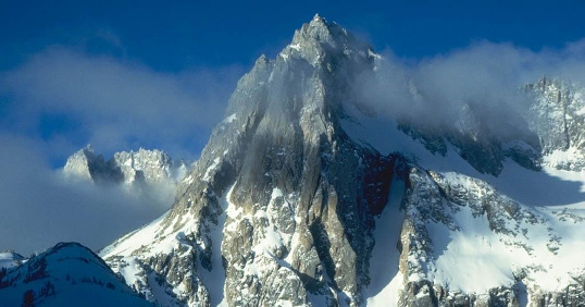
Global Warming Impact on Ecosystems
European Geographical Studies, 2020, 7(1): 3-7.
Number of views: 427 Download in PDF
2. Nikolai A. BityukovEuropean Geographical Studies, 2020, 7(1): 3-7.
Abstract:
The impact of climate change on a particular species can ripple through a food web and affect a wide range of other organisms. Climate change and shifts in ecological conditions could support the spread of pathogens, parasites, and diseases, with potentially serious effects on human health, agriculture. Climate change, along with habitat destruction and pollution, is one of the important stressors that can contribute to species extinction. It has been established that the most vulnerable system is the Black Sea coastline, which has a strategic importance for the rehabilitation of the country’s economy and development of foreign trade.
The impact of climate change on a particular species can ripple through a food web and affect a wide range of other organisms. Climate change and shifts in ecological conditions could support the spread of pathogens, parasites, and diseases, with potentially serious effects on human health, agriculture. Climate change, along with habitat destruction and pollution, is one of the important stressors that can contribute to species extinction. It has been established that the most vulnerable system is the Black Sea coastline, which has a strategic importance for the rehabilitation of the country’s economy and development of foreign trade.
Number of views: 427 Download in PDF
Water Balance of Small River Basins in the Sochi Black Sea Coast
European Geographical Studies, 2020, 7(1): 8-30.
Number of views: 430 Download in PDF
3. Jelisavka Bulatović, Goran RajovićEuropean Geographical Studies, 2020, 7(1): 8-30.
Abstract:
The article is devoted to the analysis of the hydrological regime of small rivers of the Black sea coast of the Caucasus, located in the mid-mountain and low-mountain zones. Based on the GIS-technologies, maps of the distribution of high-altitude zones of these rivers' basins with hypsographic curves have been developed. For the mid-mountain zone of the Sochi Black sea region, the analysis of the hydrological regime of the Psiy river basin with a catchment area of 20.4 km2 and an average height of 664 m above sea level (a tributary of the Shakhe river) is given. To characterize the low-mountain hydrology, we consider the Kuapse river catchment area with an area of 14.6 km2 and an average height of 322 m, which flows into the Black sea. It was found that the input part of the water balance of these rivers in the form of precipitation measured at weather stations in the estuaries of rivers is understated due to the high-altitude zoning of catchments. To account the influence of this factor, the correction coefficients were calculated equal to an increase in precipitation by 4.5 % for every 100 m of elevation in the mid-mountain zone, and by 17.3 % per 100 m of elevation in the low – mountain zone. As a result of calculations for the mid-mountain zone, it was found that for r. Psii the main part of the balance is occupied by shallow-water ground nutrition – in total, it reaches 66 % with slope runoff. The total evaporation here is about 1/3 of the balance. For the low-mountain zone, the annual water balance of the Kuapse river basin is as follows: in mm of layer 3520 = 1539 + 1981 or in % 00=44.0 + 56.0. Here precipitation is spent on 44 % on runoff, and 56 % is spent on total evaporation. During the cold period, more than half of the precipitation goes to runoff, and only 45 % − to total evaporation. During the warm period, out of 1644 mm of precipitation, 533 mm (31.0 %) is spent on runoff, and the remaining 1111 mm (69.0 %) is total evaporation.
The article is devoted to the analysis of the hydrological regime of small rivers of the Black sea coast of the Caucasus, located in the mid-mountain and low-mountain zones. Based on the GIS-technologies, maps of the distribution of high-altitude zones of these rivers' basins with hypsographic curves have been developed. For the mid-mountain zone of the Sochi Black sea region, the analysis of the hydrological regime of the Psiy river basin with a catchment area of 20.4 km2 and an average height of 664 m above sea level (a tributary of the Shakhe river) is given. To characterize the low-mountain hydrology, we consider the Kuapse river catchment area with an area of 14.6 km2 and an average height of 322 m, which flows into the Black sea. It was found that the input part of the water balance of these rivers in the form of precipitation measured at weather stations in the estuaries of rivers is understated due to the high-altitude zoning of catchments. To account the influence of this factor, the correction coefficients were calculated equal to an increase in precipitation by 4.5 % for every 100 m of elevation in the mid-mountain zone, and by 17.3 % per 100 m of elevation in the low – mountain zone. As a result of calculations for the mid-mountain zone, it was found that for r. Psii the main part of the balance is occupied by shallow-water ground nutrition – in total, it reaches 66 % with slope runoff. The total evaporation here is about 1/3 of the balance. For the low-mountain zone, the annual water balance of the Kuapse river basin is as follows: in mm of layer 3520 = 1539 + 1981 or in % 00=44.0 + 56.0. Here precipitation is spent on 44 % on runoff, and 56 % is spent on total evaporation. During the cold period, more than half of the precipitation goes to runoff, and only 45 % − to total evaporation. During the warm period, out of 1644 mm of precipitation, 533 mm (31.0 %) is spent on runoff, and the remaining 1111 mm (69.0 %) is total evaporation.
Number of views: 430 Download in PDF
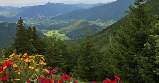
Trešnjevička Smail River and Enviroment – Mountain Beauty: A Geographical Review
European Geographical Studies, 2020, 7(1): 31-36.
Number of views: 427 Download in PDF
4. Elizbar Sh. Elizbarashvili, Mariya E. Elizbarashvili, Shalva E. Elizbarashvili, Nato B. KutaladzeEuropean Geographical Studies, 2020, 7(1): 31-36.
Abstract:
The Trešnjevik smail river springs at the foot of the Trešnjevik pass (1573 m above sea level), formed by "Water Source" and "Smaller Watercourse". In the upper course, on the left side, it receives small streams from the localities of Garevina and Osoja, while in the middle course, it receives streams Lomovi 1 and Lomovi 2. It flows into Rajova (Rajović) Rijeka near alluvial plains Milićević and alluvial plains Rajović. In the middle course, the Trešnjevička River on the left side formed the alluvial plain of Novović, at the foot of Lomovi a small alluvial plain on the right and left side and the most widespread in the basin of Rajova (Rajovića) River – alluvial plains Milićević. In Trešnjevičkoj smail river their habitat in the river and found the brown trout, which at the present time there are less and less. There are many reasons for the poor state of the brown trout. The two most destructive techniques are dynamite hunting, followed by net hunting. On Trešnjevik environment and you can spend a great time – skiing, walking, doing sports or hunting and fishing, and the environment itself is a great choice for all kinds of recreation in nature, as well as for all lovers and admirers of almost untouched nature.
The Trešnjevik smail river springs at the foot of the Trešnjevik pass (1573 m above sea level), formed by "Water Source" and "Smaller Watercourse". In the upper course, on the left side, it receives small streams from the localities of Garevina and Osoja, while in the middle course, it receives streams Lomovi 1 and Lomovi 2. It flows into Rajova (Rajović) Rijeka near alluvial plains Milićević and alluvial plains Rajović. In the middle course, the Trešnjevička River on the left side formed the alluvial plain of Novović, at the foot of Lomovi a small alluvial plain on the right and left side and the most widespread in the basin of Rajova (Rajovića) River – alluvial plains Milićević. In Trešnjevičkoj smail river their habitat in the river and found the brown trout, which at the present time there are less and less. There are many reasons for the poor state of the brown trout. The two most destructive techniques are dynamite hunting, followed by net hunting. On Trešnjevik environment and you can spend a great time – skiing, walking, doing sports or hunting and fishing, and the environment itself is a great choice for all kinds of recreation in nature, as well as for all lovers and admirers of almost untouched nature.
Number of views: 427 Download in PDF
Waves of Heat and Cold over the Territory of Georgia in Terms of Global Warming
European Geographical Studies, 2020, 7(1): 37-47.
Number of views: 406 Download in PDF
5. Lali U. Shavliashvili, Marine A. Arabidze, Elina M. Bakradze, Gulchina P. Kuchava, Georgi I. KordzakhiaEuropean Geographical Studies, 2020, 7(1): 37-47.
Abstract:
Based on the observations of 12 meteorological stations, the statistical structure of heat and cold waves in Georgia has been investigated. The average continuous, total, and longest wavelengths, the probability of their realization, the distribution area, and the repeatability period are determined. The long-term course of the total duration of the waves of heat and cold is investigated. The rate of change, the coefficient of determination and the criterion for the statistical significance of changes were estimated. The average total duration of heat waves per year in Georgia ranges from 13-20 days, with a maximum on the Black Sea coast and in the mountains. The total duration of cold waves is 10-14 days, with a maximum on the Black Sea coast, in the Colchis Lowland and on the plains of Eastern Georgia. The greatest total duration of heat waves is 40-90 days, and the greatest total duration of cold waves is 20-50 days. The continuous duration of heat waves ranges from 6-11 days and averages over the territory of about 8 days, and the duration of cold waves ranges from 6-8 days and averages 7 days, which is in good agreement with the process of transformation of air masses.
Based on the observations of 12 meteorological stations, the statistical structure of heat and cold waves in Georgia has been investigated. The average continuous, total, and longest wavelengths, the probability of their realization, the distribution area, and the repeatability period are determined. The long-term course of the total duration of the waves of heat and cold is investigated. The rate of change, the coefficient of determination and the criterion for the statistical significance of changes were estimated. The average total duration of heat waves per year in Georgia ranges from 13-20 days, with a maximum on the Black Sea coast and in the mountains. The total duration of cold waves is 10-14 days, with a maximum on the Black Sea coast, in the Colchis Lowland and on the plains of Eastern Georgia. The greatest total duration of heat waves is 40-90 days, and the greatest total duration of cold waves is 20-50 days. The continuous duration of heat waves ranges from 6-11 days and averages over the territory of about 8 days, and the duration of cold waves ranges from 6-8 days and averages 7 days, which is in good agreement with the process of transformation of air masses.
Number of views: 406 Download in PDF
Contamination of Soils by Arsenic in Ambrolauri Municipality and Its Impact on the Health of the Population
European Geographical Studies, 2020, 7(1): 48-56.
Number of views: 408 Download in PDF
6. Tsisana Z. BasilashviliEuropean Geographical Studies, 2020, 7(1): 48-56.
Abstract:
In 2019, in Ambrolauri municipality, the level of soil contamination with arsenic as a result of exposure to hazardous industrial waste containing arsenic of the Racha Mining Chemical Plant was studied. In particular, a study was conducted on arsenic contamination of the soils of the villages Uravi, Abari, Utseri, Likheti and Sori Valleys. Revealed that: According to the results of the study, of Uravi soils are the most polluted in arsenic; There is less arsenic pollution in the village of Utsera, Sori Valley and the village of Likheti (average level of pollution); The village of Abara is relatively clean, a small area where arsenic contamination was observed. It should be noted that in all cases the arsenic content is higher in the soil top (0-5 cm depth) than in the lower layer (5-20 cm depth). The health condition of the population of Ambrolauri municipality has been revealed. Based on the 2016 statistical data of the National Center for Disease Control and Public Health, the population of Racha-Lechkhumi and Kvemo Svaneti among the regions of Georgia has the first place in terms of malignant tumours and diabetes.
In 2019, in Ambrolauri municipality, the level of soil contamination with arsenic as a result of exposure to hazardous industrial waste containing arsenic of the Racha Mining Chemical Plant was studied. In particular, a study was conducted on arsenic contamination of the soils of the villages Uravi, Abari, Utseri, Likheti and Sori Valleys. Revealed that: According to the results of the study, of Uravi soils are the most polluted in arsenic; There is less arsenic pollution in the village of Utsera, Sori Valley and the village of Likheti (average level of pollution); The village of Abara is relatively clean, a small area where arsenic contamination was observed. It should be noted that in all cases the arsenic content is higher in the soil top (0-5 cm depth) than in the lower layer (5-20 cm depth). The health condition of the population of Ambrolauri municipality has been revealed. Based on the 2016 statistical data of the National Center for Disease Control and Public Health, the population of Racha-Lechkhumi and Kvemo Svaneti among the regions of Georgia has the first place in terms of malignant tumours and diabetes.
Number of views: 408 Download in PDF
Forest Cover for the Safety of Biosphere and Environment
European Geographical Studies, 2020, 7(1): 57-67.
Number of views: 402 Download in PDF
7. Tsisana Z. BasilashviliEuropean Geographical Studies, 2020, 7(1): 57-67.
Abstract:
The extreme events resulting from climate change are discussed: floods, decline of fresh water and land resources, draughts, crop failure, desertification, etc. The reasons causing climate change are examined, main of them being the anthropogenic increase of carbon dioxide concentration in the atmosphere. Its absorption is possible only by green vegetation through the process of photosynthesis, as a result of which large amount of oxygen is produced being a principal source of existence for all living organisms. Forest is rich in many kinds of food and medical products. It is a protector of water and land resources as well as a filter for purifying air and the water. The importance of forest cover in mountain regions is described, where it protects settlements, roads and fields from floods and mudflows, erosion processes, landslides and avalanches. Forest is regulating the water regime of mountain rivers curtailing floods and preventing them from drying up. The data are presented on the state of forest cover in Georgia and the world over. Resulting from unsystematic felling forests are becoming sparse, are losing their protective functions, thousands of plant and animal species are wiped out. In all settlements the population and local authorities must care for reforestation and afforestation that will facilitate the reproduction of animals and birds, increase in crop capacity and the development of resort-recreational, and ecotourism activities. While planting the forests useful kinds should be chosen and cutting dawn must be permitted for only elderly and sick trees and considering the amount of annual accretion. Very important is the raising of public awareness. Only the knowledge, correct education and love to the nature may save the biosphere and environment from the destruction and produce economic and social prosperity.
The extreme events resulting from climate change are discussed: floods, decline of fresh water and land resources, draughts, crop failure, desertification, etc. The reasons causing climate change are examined, main of them being the anthropogenic increase of carbon dioxide concentration in the atmosphere. Its absorption is possible only by green vegetation through the process of photosynthesis, as a result of which large amount of oxygen is produced being a principal source of existence for all living organisms. Forest is rich in many kinds of food and medical products. It is a protector of water and land resources as well as a filter for purifying air and the water. The importance of forest cover in mountain regions is described, where it protects settlements, roads and fields from floods and mudflows, erosion processes, landslides and avalanches. Forest is regulating the water regime of mountain rivers curtailing floods and preventing them from drying up. The data are presented on the state of forest cover in Georgia and the world over. Resulting from unsystematic felling forests are becoming sparse, are losing their protective functions, thousands of plant and animal species are wiped out. In all settlements the population and local authorities must care for reforestation and afforestation that will facilitate the reproduction of animals and birds, increase in crop capacity and the development of resort-recreational, and ecotourism activities. While planting the forests useful kinds should be chosen and cutting dawn must be permitted for only elderly and sick trees and considering the amount of annual accretion. Very important is the raising of public awareness. Only the knowledge, correct education and love to the nature may save the biosphere and environment from the destruction and produce economic and social prosperity.
Number of views: 402 Download in PDF
Current Problems of Fresh Water and Trends in the Flow of Water in the Rivers of the South Caucasus in Georgia
European Geographical Studies, 2020, 7(1): 68-77.
Number of views: 427 Download in PDF
8. European Geographical Studies, 2020, 7(1): 68-77.
Abstract:
Due to global warming and the Earth’s overpopulation, vital fresh water resources are expected to suffer irreplaceable losses; thus, fresh water shortage is the most acute problem of our time. The paper presents the characteristics of the state and problems of freshwater resources, there is a large disproportion in their distribution. Having studied the long-term dynamics of river water flow, it was found that with increasing intensity of the Caucasus glaciers’ melting, river water flow increases here while in non-glacial zones, it decreases. Numerical values of their annual changes have been established. Particularly acute problems of water scarcity are expected in eastern Georgia, where, due to the dry climate, the shortage of irrigation water will lead to a decrease in yield – the source of livelihood of the local population. Expected droughts will contribute to desertification processes. Therefore, it is necessary to rationally use the available water resources and take measures to replenish them in order to overcome the expected economic and social crisis and ensure environmental safety.
Due to global warming and the Earth’s overpopulation, vital fresh water resources are expected to suffer irreplaceable losses; thus, fresh water shortage is the most acute problem of our time. The paper presents the characteristics of the state and problems of freshwater resources, there is a large disproportion in their distribution. Having studied the long-term dynamics of river water flow, it was found that with increasing intensity of the Caucasus glaciers’ melting, river water flow increases here while in non-glacial zones, it decreases. Numerical values of their annual changes have been established. Particularly acute problems of water scarcity are expected in eastern Georgia, where, due to the dry climate, the shortage of irrigation water will lead to a decrease in yield – the source of livelihood of the local population. Expected droughts will contribute to desertification processes. Therefore, it is necessary to rationally use the available water resources and take measures to replenish them in order to overcome the expected economic and social crisis and ensure environmental safety.
Number of views: 427 Download in PDF